Top products from r/Yosemite
We found 20 product mentions on r/Yosemite. We ranked the 28 resulting products by number of redditors who mentioned them. Here are the top 20.
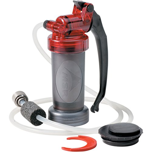
1. MSR MiniWorks EX Microfilter Water Filter
Sentiment score: 0
Number of reviews: 1
Microfilter water filter pump for hiking, backpacking, camping, travel, survival, and emergency preparednessReplaceable carbon and ceramic filter removes bacteria, protozoa, organic compounds, and particulate, delivering clean, taste and odor-free waterPumps at a rate of one liter per minute; compat...
 Show Reddit reviews
2. [SGS Certified] RANDY SUN Unisex Waterproof & Breathable Hiking/Trekking/Ski Socks
Sentiment score: 0
Number of reviews: 1
Size: Suitable for most adults.Design: These well-made gloves feature a black, white hand-skeleton print that looks cool and special, suitable for teens and adults.Material: Made of polyester, this openwork glove is soft to the touch and keeps your hands warm in winter, giving you a comfortable wear...
![[SGS Certified] RANDY SUN Unisex Waterproof & Breathable Hiking/Trekking/Ski Socks](https://m.media-amazon.com/images/I/41QsMfm+C8L.jpg) Show Reddit reviews
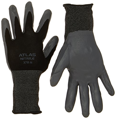
Show Reddit reviews3. Atlas 370M Nitrile Tough Assembly Grip 370 Work Gloves, Medium
Sentiment score: 1
Number of reviews: 1
Nylon knit shellNitrile dip palmExcellent flexibilityOpen backSize medium
 Show Reddit reviews
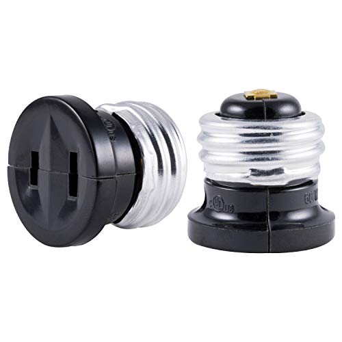
4. GE Polarized Handy Plug, Convert, Easy-to-Install, UL Listed, Black, 54276, Light Bulb to Outlet Socket Adapter | 2 Pack, 2 Each
Sentiment score: 0
Number of reviews: 1
Adapter: Transform a light socket into an outlet when you need one with the GE Polarized handy outlet plugConvenient: Use in a space that might not have an outlet where you need in most like in your garage, workshop or shedEasy to Install : Turn off the light fixture, remove existing bulb, and simpl...
 Show Reddit reviews
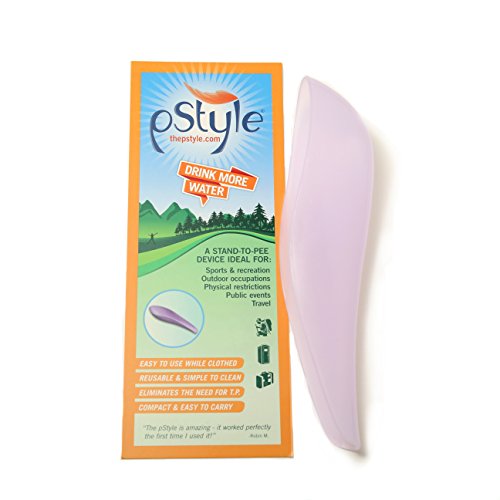
5. pStyle - Lavender
Sentiment score: 0
Number of reviews: 1
Stand up and pee without removing clothing.Easy to use, reusable, and simple to clean. Eliminates the need for toilet paper.The pStyle is a women owned and operated business.
 Show Reddit reviews
6. WAG BAG Toilet in a Bag Waste Kit, 12/cs
Sentiment score: 0
Number of reviews: 1
Easy to use
 Show Reddit reviews
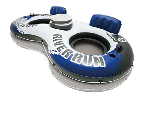
7. Intex River Run II
Sentiment score: 1
Number of reviews: 1
104 inches 56 inchesAdult18 gauge vinylMesh bottom keeps you coolBuilt in backrest for easy cruising
 Show Reddit reviews
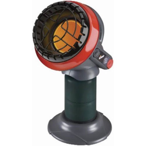
8. Mr. Heater F215100 MH4B Little Buddy 3800-BTU Indoor Safe Propane Heater, Medium
Sentiment score: 0
Number of reviews: 1
Indoor-safe portable propane heater for rooms up to 95 square feet. THIS UNIT IS NOT INTENDED FOR GOLF CART USE OR FOR MOTORIZED VEHICLES.Continuous odor-free, 45-degree heating angle. Maximum Elevation (Ft) 7000 Feet. Automatic low oxygen shut-off system (ODS). Perfect solution for heating small en...
 Show Reddit reviews
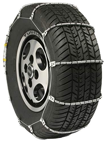
9. Security Chain Company SC1032 Radial Chain Cable Traction Tire Chain - Set of 2
Sentiment score: 1
Number of reviews: 1
Traction; chain, safety, snow
 Show Reddit reviews
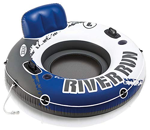
10. Intex River Run I Sport Lounge, Inflatable Water Float, 53" Diameter
Sentiment score: 1
Number of reviews: 1
Have fun floating in the pool or at the lake with the Index River run IDesigned with a built-in backrest for easy cruising and a mesh bottom that keeps you coolAn all around grab rope is included for ease of use53 inches Diameter circleMesh bottom to keep coolBuilt in backrest for comfort2 heavy dut...
 Show Reddit reviews
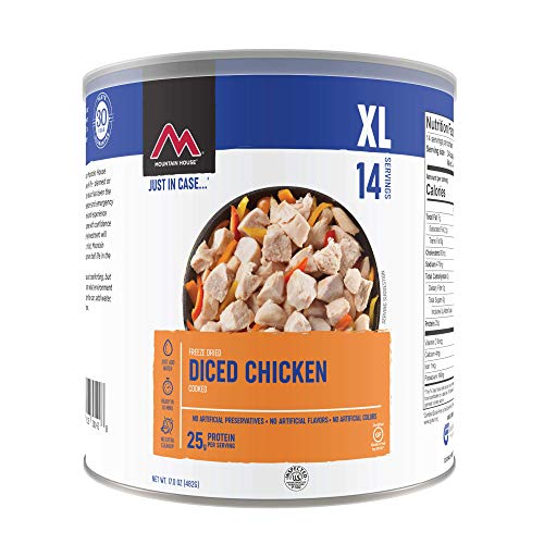
11. Mountain House Cooked Diced Chicken #10 Can
Sentiment score: 0
Number of reviews: 1
FREEZE DRIED MEAT - An excellent source of protein, use Mountain House cooked, diced chicken in any recipe requiring chicken like stews, soups, and chili.NO ARTIFICIAL ANYTHING - Made with no preservatives, artificial flavors or colors. Can contains 14 total servings. Great for feeding a family or a...
 Show Reddit reviews
12. Geology of the Sierra Nevada (California Natural History Guides)
Sentiment score: 1
Number of reviews: 1
 Show Reddit reviews
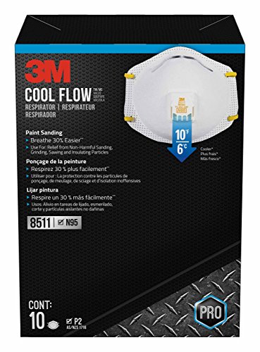
13. 3M 8511 Respirator, N95, Cool Flow Valve (10-Pack)
Sentiment score: 1
Number of reviews: 1
Niosh approved N95 for at least 95 percent filtration efficiency against certain non oil based particles and aerosols3M cool flow valve helps reduce heat build up inside the respiratorBreathe 30 percentage easier compared to 3M 8200, breathe easier is defined as initial pressure dropADJUSTABLE M NOS...
 Show Reddit reviews
14. Yosemite National Park [Map Pack Bundle] (National Geographic Trails Illustrated Map)
Sentiment score: 1
Number of reviews: 1
National Geographic Maps: National Geographic's waterproof and tear-resistant maps provide travelers with the perfect combination of detail and perspective, a necessity for any adventure.Pocket Naturalist Guides: Waterford Press' Pocket Naturalist Guides are filled with accurate and lifelike illustr...
![Yosemite National Park [Map Pack Bundle] (National Geographic Trails Illustrated Map)](https://m.media-amazon.com/images/I/51KQV73GLRL.jpg) Show Reddit reviews
Show Reddit reviews15. Yosemite NW: Hetch Hetchy Reservoir (National Geographic Trails Illustrated Map (307))
Sentiment score: 0
Number of reviews: 1
Scale: 1 : 80000Folded Dimensions: 4.25 x 9.25Waterproof: yesRecommended Use: Hiking, backpacking in Sequoia and Kings Canyon National Park area
 Show Reddit reviews
16. Yosemite National Park (National Geographic Trails Illustrated Map (206))
Sentiment score: 0
Number of reviews: 1
Scale: 1 : 80000Folded Dimensions: 4.25 x 9.25Waterproof: yesRecommended Use: Hiking, backpacking in Sequoia and Kings Canyon National Park area
 Show Reddit reviews
17. Eastern Sierra and Death Valley Camping With Privacy: Your Guide To The Most Private Campsites Near Mammoth Lakes, Tuolumne Meadows, Death Valley, and Beyond
Sentiment score: 0
Number of reviews: 1
 Show Reddit reviews


I completely understand where you're coming from (and I think what you're after).
I picked up this book right in the Yosemite Village Store (as I was leaving Yosemite for what I feared might be a long time). The Yosemite Grant
It's a very detailed history of the early years of the park (1864-1906) in a nice larger format book.
For other ideas, I'd browse around here are well.
Yosemite Conservancy In fact, pulling up that link just inspired me to order a copy of "They Yosemite Valley and the Mariposa Grove", which I hadn't seen before.
If you haven't already, definitely get a copy of "The Yosemite" by John Muir. He's an incredible writer and a crazy man at times - very adventurous. There are endless variety of publications to choose from, and it's a free eBook too. All of Muir's writings are worth your time.
From another angle, I actually also found this book to be really enjoyable: Geology Underfoot in Yosemite National Park. Not for everyone, but it's a very accessible geological history, shedding light into how the landscape formed. As I hiked around the valley loop last fall it was very cool to note, as we crossed a high sort of berm that stuck out like a sore thumb, that it was in fact the terminal moraine of the glacier that carved the valley, and later acted as a damn to fill the valley, giving it its flat floor. The book gave me a better appreciation of what I was seeing within the park. (high nerd factor there though, not for everyone)
And finally, if you want to go waaaay back to some great source material, everything that is in the public domain seems to be cataloged and digitized here Yosemite Online
Enjoy!
By no means am I an expert on the hike, but I can help for sure.
The gloves I was recommended were these and they worked great. They have similar brands/types at Home Depot.
As others have said, especially on a day hike, it'd be best to only fill up a little water at a time. The Vernal Falls footbridge station was closed and has been for a month or more.. so check the status or ask around before you go. Bring a filter so you don't have to rely on it and fill up at Little Yosemite Valley. There is water access above each waterfall, but use caution on where you decide to pull water. Basically, in this photo, fill up on or near the sand beach where the background people are.. avoid rocks and fast-moving water.
Start early, like 5-6AM early.. pack the 10 essentials (or most of them at least) and just be sure to check the weather before you go.
Get a Supertopo climbing guidebook and look up the climber trails. These trails are unofficial climber maintained trails and are generally safe but more difficult hiking with frequent route finding by following rock stacks. The approaches to El Capitan, Washington Column, Glacier Point Apron, and Middle Cathedral offer some really great views most tourists don’t get to see. The hike to the base of Washington Column (look up the climb “Astroman”) puts you directly across from Half Dome. The hike up to El Cap (look up the climb “Pine Line”) is an easy 15 min walk. Once you get to the base of El Cap, go left and follow the base for 5 min. There is a gigantic ledge that looks strait up the Nose of El Cap. The Glacier Point Apron trail (look up the climb “The Grack”) starts at the parking lot across from Upper Pines campground and cuts into the forest to the base of Glacier Point. Once you get to the base, go left and follow it along the base.
> thanks again. one last question - are most trails clearly marked?
Assuming there's no snow obfuscation you'd have to really really screw up to lose any of the trails you'll be on.
> any recommendation for maps / guides and where to best get them?
My favorite maps of the park are the National Geographic Trails Illustrated series. You can find these everywhere (And don't need all 4 if you won't be going into the far corners of the park)
http://www.amazon.com/Yosemite-National-Bundle-Geographic-Illustrated/dp/1597754064
(And that's my photo is on the cover of the Hetch Hetchy one :) )
> assume there's no cell service so using online guides is out.
Cell service in the valley is far better than it used to be but I wouldn't ever count on it being available.
I bought two sets of these for a trip last year. Might be cheaper than renting them. Used them twice; they're surprisingly well made and definitely got the job done.
Staying in Wawona campground, but will be exploring the hits in the Valley. Won't be headed north of the valley since we're coming back on Sunday and time is precious.
Planning on floating down the river... have a ton of these and these, so if you see just such a flotilla on Friday or Saturday, that's us! Too bad there's no secret Redditor hand signal ;)
Edit: or IS there?!
I recommend a particulate respirator if anyone is going to be in the thick of it. I wore one in Yosemite one year when it was really smokey during my visit, and it's like breathing in clean air even when it's smokey. Hike on.
https://www.amazon.com/gp/product/B0002YKBV2/(Not sure if that Amazon link is still pointing to the one I purchased awhile back since that one says sanding, but these are ones I used: http://www.3m.com/3M/en_US/company-us/all-3m-products/~/3M-Particulate-Respirator-8511-N95-80-EA-Case?N=5002385+3294780243&rt=rud)I bring this and 2 Nalgene bottles with me when I hike in the Sierras. Worth every penny. You can get fresh drinking water from any river or stream.
https://www.amazon.com/MSR-56425-MiniWorks-EX-Microfilter/dp/B000BBF2RY/ref=sr_1_5?ie=UTF8&qid=1504405572&sr=8-5&keywords=water+filter+pump
While it's not free, it's wayyy better than the NPS map. The Nat Geo Yosemite map has Topo lines, mileage, and generally more detail than the basic NPS map... Only 10 bucks too. I don't think NPS will send you one of theirs for free unfortunately.
Usually, the envelope you put the money in will have a detachable ticket you place under a clip or something on the numbered stake indicating the site. You'd put down things like your name, the date, and the site number and 'reserve' it by paying the fee. I've never had a problem doing this and then leaving to go do other things. Sometimes I'll leave a chair or something I don't care too much about on the picnic table so it's clear that the site is occupied.
Check out this book:
https://www.amazon.com/Eastern-Sierra-Valley-Camping-Privacy/dp/1515196208
http://www.amazon.com/Mr-Heater-F215100-3800-BTU-Propane/dp/B001CFRF7I
https://www.amazon.com/Off-Wall-Yosemite-Michael-Ghiglieri/dp/0970097360
I am a woman and I 100% suggest this. Best purchase I have ever made.
https://www.amazon.com/pStyle-Lavender/dp/B002AA8GDG/ref=sr_1_6_a_it?ie=UTF8&qid=1524606196&sr=8-6&keywords=pee+funnel
Get some freeze-dried chicken, add some veggies, cook over a stove to make soup or a stew.
If you have an Edison bulb to outlet, you could get some power from the light bulb in each cabin. I would not suggest leaving it plugged in as it might be against the rules, especially when housekeeping comes by.
Two things I've worn while hiking in the rain made all the difference for me: