Best remote sensing & gis books according to redditors
We found 24 Reddit comments discussing the best remote sensing & gis books. We ranked the 15 resulting products by number of redditors who mentioned them. Here are the top 20.
We found 24 Reddit comments discussing the best remote sensing & gis books. We ranked the 15 resulting products by number of redditors who mentioned them. Here are the top 20.


Here's a bunch of resources for ya.
Start by checking out OpenTopography. They have data for free download as well as a great tools page:
https://opentopography.org/
​
For free software I recommend checking out:
Cloud Compare https://www.danielgm.net/cc/
QTReader http://appliedimagery.com/download/qtreader-64-bit/
and Fusion http://forsys.cfr.washington.edu/FUSION/fusion_overview.html
​
Also free for small datasets is Lastools. The creator, Martin Isenburg has an excellent blog as well.
https://rapidlasso.com/lastools/
https://rapidlasso.com/blog/
​
If you know python or R there are some great packages:
laspy https://laspy.readthedocs.io/en/latest/
lidR https://github.com/Jean-Romain/lidR
​
For educational resources:
I've taken some good courses online with Penn State World Campus. I haven't taken their lidar one, but it looks pretty good.
https://www.e-education.psu.edu/geog481/syllabus
There are lots of resources out there you don't have to pay for, and colleges are always a bit behind the industry. I see more programs popping up these days that teach not just GIS but focus more on remote sensing and geodesy. I would look for something with that kind of focus rather than your standard GIS program. Honestly, you can learn a lot about the work if you try out some mapping using a drone with a camera and then create a point cloud using structure from motion (aka phodar). Software like Pix4D, Agisoft Photoscan have free trials I think.
For lidar textbooks I recommend the one by Shan and Toth:
https://www.amazon.com/Topographic-Laser-Ranging-Scanning-Principles-ebook/dp/B009NZVX2W
Also, it's always a good idea to read up on and understand accuracy standards and file formats at some point:
https://www.asprs.org/a/society/committees/standards/Positional_Accuracy_Standards.pdf
https://www.asprs.org/wp-content/uploads/2010/12/LAS_1_4_r13.pdf
​
For drone based lidar, the company to pay attention to these days is Phoenix LiDAR.
https://www.phoenixlidar.com/
​
Hopefully gives you some of what you're looking for. Best of luck!
USDA, FBI, CIA, USACE, USNAVY, USARMY, USAIRFFORCE, USNPS, USF&W, HHS, USFS, NASA (for rocket launches) and multiple state governement agencies too, from my experience working with these data and professionals directly: TDEC, TWRA, TVA.
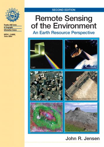
This is in no way an exhaustive list, and I can provide context for each of these groups. Mostly this is just from Jensen's Remote Sensing of the physical environment 2nd, which, even though is from 2006 and there is new data for these topics now, does a wonderful job of describing topics for those without STEM backgrounds.
The ease of coding it should be independent of the number of values you are working with if you are using a software capable of matrix multiplication like MATLAB. I've coded it manually in R, largely because I find the pre-written packages poorly notated—it's not too difficult.
> What book could I refer for just the basic introduction to Kriging?
This is a good introduction, I've found. It seems to come from this book.
I'm in my last class finishing up my certificate through Penn State. One thing I can tell you is put all your class projects into an online portfolio. I didn't do that so I will have to go back track and put them all up.
I have no background in GIS and started the program out of genuine interest. The program was well worth the money but since I have no prior experience it was kind of a GIS intro/immersion program. Basically I wouldn't apply to GIS jobs based on my certificate alone. Because of this I plan on studying on my own using ESRI's books to reinforce what I learned through Penn State . Again, I plan on posting the associated projects from these books into an online portfolio.
Current books I will be going through:
http://www.amazon.com/gp/aw/d/1589482824/ref=mp_s_a_1_1?qid=1405071816&sr=8-1&pi=SY200_QL40
http://www.amazon.com/gp/aw/d/1589483359/ref=mp_s_a_1_1?qid=1405071858&sr=8-1&pi=SY200_QL40
http://www.amazon.com/gp/aw/d/158948214X/ref=mp_s_a_1_1?qid=1405071905&sr=8-1&pi=SY200_QL40
Congrats on your promotion! I did my undergrad in Geography and am almost done with my MPH, so fellow GIS person here. There is an interest group in the American Association of Geographers you can reach out to if you haven't already. I'm not sure what your baseline is for public health, but I've included two books I've liked and used for reference on occasion. I'm sure you'll know all the geography concepts, but it's nice to see how they relate to the public health side.
I know a lot of universities offer free classes for their employees, maybe you could take a couple of public health courses if you were so inclined just to get a good baseline. I'm not sure what area of public health your doing your work in, but it's never a bad idea to pay attention to publications to see what's new.
https://www.amazon.com/Cartographies-Disease-Mapping-Medicine-expanded/dp/1589484673/ref=sr_1_6?ie=UTF8&qid=1498073326&sr=8-6&keywords=GIS+public+health
https://www.amazon.com/GIS-Public-Health-Ellen-Cromley/dp/1609187504/ref=sr_1_1?ie=UTF8&qid=1498073326&sr=8-1&keywords=GIS+public+health
You might appreciate this book on remote sensing (used of course, also check eBay) I came across in grad school (spatial analysis & processing satellite imagery) that's more along the lines of algorithmic processing in post production rather than composition in the field. It's a great look (academically speaking) at the language of math as it applies to handling rasters.
[Ninja edits: jfc autocorrect...]
Yes there is my buddy. But don't do it in your backyard. If you do, please inform the closest university.
The program itself (I learned on the 2013 version) comes with three guides, as I recall. The tour guide is the only one that comes to mind at the moment. Maybe the field guide is another. I used the tour guide primarily. The annoying thing was learning the program with the guides that were not updated. So if a lesson says it should take x amount of time, it will take more, due to you having to figure out where certain tools have been moved to.
Here is the 2010 tour guide, its probably the one I used.
I would also suggest taking the time to learn about the chip & subset tool, and supervised and unsupervised classification. Those are the most powerful tools I learned to use. I really like remote sensing, and would love to land a job doing at least some rs. Its a great way to create your own raster data.
If you are looking for reading on the topic of RS, I used two books by John R. Jensen, Remote Sensing of the Environment, and Introductory Digital Image Processing. The latter being the most useful imo.
I used this one for a GIS Criminal Justice class at my university
GIS Tutorial for Crime Analysis (GIS Tutorials) https://www.amazon.com/dp/158948214X/ref=cm_sw_r_cp_apa_lZrzzbVF7ZZ23
This.
Also a decent resource IMO.:
http://www.amazon.com/Getting-Know-ArcGIS-Desktop-Michael/dp/1589483081/ref=sr_1_1?ie=UTF8&qid=1417111106&sr=8-1&keywords=arcgis+10.2
I haven't seen evidence to say that GIS is necessary to get a job, but I still strongly recommend it. I know several people, myself included, who have been told that GIS experience has gotten their resumes taken out of the pile.
Even if your school doesn't offer a course on arcGIS, the company that puts out the software offers a pretty good workbook that comes with a trail of the software if you want to look at it yourself.
The Blue-Eyed Son series, by Chris Lynch.
http://www.amazon.com/Blood-Relations-Blue-eyed-Chris-Lynch/dp/1853717819/ref=ntt_at_ep_dpt_1
> Most all entry jobs require experience.
Are you trying to get an entry job into natural resources or something like a GIS technician? I can see it being pretty difficult to get a strictly GIS related job if you only had two classes at university.
Learn as much as you can from tutorials online. Try out QGIS. See what books your local library can get you. Work on your own projects.
Since you don’t have an expensive piece of paper that says you know GIS, your best bet is to start putting together a portfolio of your projects for potential employers to review.
If you can’t get access to Esri products through the university, you can get this tutorial book for ArcMap 10.3 for $32 and it comes with a 6 month trial license. There’s also this one for ArcGIS Pro (Esri’s new flagship software) for $62. I would assume it comes with a trial license as well.
If you do buy a tutorial book, always buy new. The trial license is just a code in the book to activate it. If you buy used there’s no way to know if that code has been used already or not.
If you use 3/4 Nyquist it is indeed correct that it won't be monotonic - this is the weakness of single points on the curve of a function trying to convey all of the necessary information. On the other hand, if you're curious what's going on at very fine scales - the place to look /is/ what's going on near Nyquist. Even if there are nonidealities. And you can design a metric that glosses those over, for example integrating between (say) 3/4 and Nyquist, which would be much better conditioned. The wider the bandwidth the better conditioned it is, until you just end up at SQF.
If you want to capture "sharpness," it really is optimal to just use SQF. Perceptual sharpness was simply figured out a long time ago. Hultgren's modified SQF is superior to the original, in my opinion.
The more complicated behavior I can't help you with (perhaps look in my two reference books on this topic...)
https://www.amazon.com/Modeling-Imaging-Digital-Tutorial-Engineering/dp/0819483397/ref=sr_1_3?keywords=remote+sensing+image+chain&qid=1564974865&s=gateway&sr=8-3
https://www.amazon.com/Remote-Sensing-Image-Chain-Approach/dp/0195178173/ref=sr_1_1?keywords=remote+sensing+image+chain&qid=1564974865&s=gateway&sr=8-1
Composites of smear and jitter are easy to model (even multiple smears) - just convolve several jitters or smears together with the .conv syntax. If you want to learn prysm, I would recommend keeping an eye on the v0.17 release notes. This release is due in the next little while (a few weeks, probably) and will break a lot of way the library was used in <= v0.16 to reduce the amount of vocabulary you need to know to use the library.
I'm nearing the end of my geography major. As someone who is just starting (and struggling big-time) to learn the programmatic side of things, you really have a leg up on the competition. The programming language of choice for GIS apps is Python, so if you still want to be doing some programming that is the language you want to focus on. A Geography grad avgs 50k/year. A geog major who knows python averages 75K!
Broadly speaking, I'd recommend picking up a book like ESRI's Getting to Know ArcGIS and working the examples there. http://www.amazon.com/gp/product/1589483081?keywords=arcgis&amp;qid=1450722894&amp;ref_=sr_1_2&amp;s=books&amp;sr=1-2
Get to know key terms like rasters, vectors, shapefiles, and the basic operations like clip, buffer, etc. And above all realize that everything exists in space and time, so everything can be analyzed spatially!
Well, to come up with my own shorthand definition or contrast of the two, Remote sensing is obtaining or creating data through indirect means of instrument-based measurement while GIS may do some of that but is much more the analysis and processing of said data into useful information and derivative products.
You are correct that fire mapping might make heavy use of both, but there still might be specific position or roles. A drone operator might not touch GIS for much more than AOI (are of interest) and flight path definition. Someone doing fuels mapping based on multi or hyper spectral imagery might spend the majority of their time in non-GIS software, only using GIS to generate some outputs or again with the AOI. A GIS analyst might take some of that information with other sources and then look at how many homes are at what risk, or determine evactuation routes, or just generate maps with boundaries and other information - never touching raw remote sensing beyond maybe some imagery.
This is the textbook from my intro to remote sensing class and this and this are two similar '100 level' books for GIS. You might see if you can find a copy in a local library to take a look at, as even just skimming available chapters and the chapter overviews would give you a fairly in-depth idea of what the differences are. I think if you pick a couple of certificate and degree programs, and then look at the course summaries for what's required you might get an idea of how those tracks differ. I would think you would also have some contacts within your organization you could talk with as far as getting an idea of which skillset is needed for what with how they do things.
Looking for:
https://www.amazon.com/GIS-Tutorial-Basic-Workbook-Tutorials/dp/1589484568
$5obo Paypal, Amazon, SquareCash, Venmo
>29 up votes
>138 comments
gg 'community'.
or Cressie and WIkle or Banerjee/Carlin/Gelfand.